
I've been lacking inspiration for designing levels for games so picked up a tool that cross grabs SRTM data. Shuttle Radar Topography Mission - Wikipedia, the free encyclopedia
Flythrough videos:
[ame="www.youtube.com/watch?v=bEnlqMVB4RE"]Mount Ranier, WA. Computer generated from open source map data - YouTube[/ame]
[ame=http://www.youtube.com/watch?v=qSYqgkKOxBA]Generated maps of Mongolia and end of Baja California - YouTube[/ame]
[ame=http://www.youtube.com/watch?v=-F31um25dCM]Auto generated model and texture of NYC from gps coordinates - YouTube[/ame]
Here's a generated version of mount ranier:

I had to reduce quality of the textures because I got blacklisted for consuming too much bandwidth for a while.
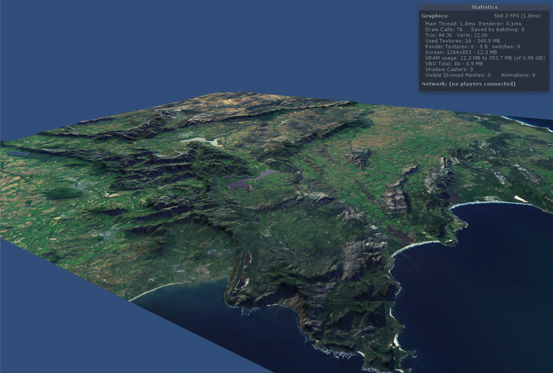
Here are 2 picks of mongolia:


Baja California:

Here's a pick of manhattan with auto generated buildings:

Kinda neat for being completely automated. I plan to redo the textures in photoshop with my own textures (cartoony) for a kids game.
Flythrough videos:
[ame="www.youtube.com/watch?v=bEnlqMVB4RE"]Mount Ranier, WA. Computer generated from open source map data - YouTube[/ame]
[ame=http://www.youtube.com/watch?v=qSYqgkKOxBA]Generated maps of Mongolia and end of Baja California - YouTube[/ame]
[ame=http://www.youtube.com/watch?v=-F31um25dCM]Auto generated model and texture of NYC from gps coordinates - YouTube[/ame]
Here's a generated version of mount ranier:
I had to reduce quality of the textures because I got blacklisted for consuming too much bandwidth for a while.
Here are 2 picks of mongolia:
Baja California:
Here's a pick of manhattan with auto generated buildings:
Kinda neat for being completely automated. I plan to redo the textures in photoshop with my own textures (cartoony) for a kids game.


") also another script to export them as .obj so I can reduce poly in blender.
also another script to export them as .obj so I can reduce poly in blender.